In many developing countries, industrialization has resulted in major environmental problems resulting in deforestation, loss of biodiversity, and water pollution. Despite environmental regulations and standards becoming increasingly complex in many countries, enforcement of these regulations remains an issue in many developing countries. Water bodies that are difficult to traverse mean that substantial manpower is needed to fully patrol and survey for polluters. Furthermore, as a clean environment is a common good, it falls to the tragedy of the commons. Polluting it is easy, cleaning it up is difficult.
Enforcement in sprawling masses of forests…
States have difficulty affording such surveillance. They also have reasons to look the other way if allowing pollution to happen may attract investors. On top of that, corruption and bureaucratic red-tape also hinder the enforcement of these laws. In several countries, declaring environmentally-friendly technological policies has been a method for certain officials to over-declare their budget needs for some pocket money.
Perhaps a more fundamental question is whether governments or companies are necessarily best placed to enforce environmental obligations when it means raising business costs. Barring sustainability-focused business models, there is little incentive for companies to self-regulate and adopt more cumbersome waste management when another easier way out is available.
Rather, the individuals who are most affected by the pollution are the residents who depend on the rivers for their clean source of water, or the trees for their fresh air. It is these people who are often disempowered within their societies, and who are unable to speak out against environmental degradation.
Giving power back to the locals
The environment belongs to the world, and everyone should have the right to have an eye on it, and to point out when pollution and degradation damage the earth. Bringing the eye to the locals by collating satellite images of their local environment can allow them to witness the harm done and increase local awareness on the extent of environmental degradation in their environment. Allowing these locals to tag incidents of pollution and degradation allows them a direct change to participate in the enforcement of environmental protection norms.
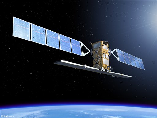
Presently, satellite monitoring has been used by various organizations to monitor environmental pollution. Crowdsourcing efforts have also been used in the past to rally public efforts where manpower and time are short. Both solutions can fill the gap of legal enforcement of environmental regulations.
Recent Uses of Satellite Imagery
Shifting away from the manpower exhaustive solution of human patrols, satellite monitoring can place a permanent eye in the sky to continuously gather data on changes in the environment in real-time. Drawing on the availability of free satellite images from NASA, this also holds potential for a low-cost solution, especially important for small local governments or poorer states seeking to enforce their environmental standards on a low budget.


Indeed, satellite images have already been used in certain pilot projects to monitor real-time deforestation and forest fires in large forest masses like the Amazon. In 2015, a partnership by the World Resource Institute, DigitalGlobe, Google, and the Indonesian government launched the Global Forest Watch Fires to monitor forest fires and deforestation in Southeast Asia. Collated information including tree cover gains and losses and fire hotspots are presented in an interactive map that is publicly accessible.
Satellite images have also been used to track water pollution. In 2018, UNESCO launched a World Water Quality Portal to monitor water resources for the purposes of reaching sustainable development goals. The portal, similar to the Global Forest Watch Fires map, also collates indicators such as turbidity and sedimentation distribution, chlorophyll-a, harmful blooms, organic absorption, and surface temperature of various water bodies. Data from the report is also included in the annual World Water Development Reports.
Crowdsourcing Efforts
Collating these satellite images and data into a database, not unlike the visualisations from GoogleEarth, locals can be encouraged to tag on these visualisations where they notice signs of deforestation or water pollution. Crowdsourcing this effort is not an unfamiliar model of public engagement. In previous searches for plane wreckages, this has allowed searchers to mobilise large numbers of members of the public to cover huge masses of oceans for the hunt.
Furthermore, engaging the public can help to improve local awareness of the state of their environmental degradation. These locals are likely to have a greater stake to maintain the pristine quality of their forests and water supplies. This also increases transparency on where there may be potential flouting of environmental standards, allowing the public to hold local governments responsible for investigating these incidents.
What this means for Singapore
Apart from informing the locals of the harm done to their environment, providing such information on a publicly-accessible database mean that individuals from other countries who have an interest in preserving the local environment can participate in the tagging as well.
For Singapore, this may also be a source of information for environmentally-conscious companies or NGOs to identify products that have been produced in a region prone to illegal deforestation or burning.
Implementation Considerations
Concerns of privacy may arise from the use of satellite images. This is increasingly a concern as more commercial companies are releasing high resolution images to both clients, and the public. In increasing the convenience of surveillance, we must also be wary of allowing governments the tools to exercise excessive surveillance for reasons unrelated to the environmental objective.
Presently, publicly available satellite images are not of sufficiently high resolution to be able to identify specific individuals. However, they may nevertheless provide visual information, such as individuals or large objects entering or leaving premises, which may be used for criminal purposes.

Forbearance is needed for the governments to utilise only lower-resolution images that nevertheless can still identify burns and pollutions. Should high-resolution satellite imagery be used, developments in international best practices on privacy may consider requiring states to redact images of individuals, residential areas, or key governmental infrastructure before uploading the satellite images to the portal.
Apart from privacy concerns, the existing digital divide in less affluent countries may pose a limitation to the uptake of this solution. While more developing countries are seeing an increase in mobile phone usage, there is still an issue of low network connectivity. According to a 2017 Deloitte Study, while an average of 82% of the people in developing countries owns a smartphone, only 56% have access to 4G connection. Hence, continued improvement in access to the Internet will be needed before more of the locals can be engaged in this initiative.
Furthermore, even with access to the Internet, strong public messaging is also needed to encourage locals to participate in downloading the application or accessing the portal and to tag instances of environmental damage. Presently, even in developing countries with higher Internet usage, the majority of the usage is focused on social media and messaging services, with Facebook and WhatsApp being the most popular applications. Webpage designers and governments would have to consider how best to attract local uptake of the application based on.
Eyes in the Sky, Legs on the Ground
Technology has increasingly made information more accessible by allowing large swathes of data to be presented online. Mobile phone and social media usage have also penetrated developing countries, delivering the Internet to communities that once stood on the other side of the digital divide.
However, organizations who wish to make use of the potential of these technologies to reach out to the public will have to be sensitive to the design of the output and to be aware of the technological literacy of the population. How the portal will look, and how individual users can tag what they view to be environmental damage are key components of features that would attract users and improve the outreach to the everyman.
Having eyes in the sky is only one step towards improving environmental protection. A successful environmental protection scheme also requires arms and legs on the ground to enforce environmental protection rules. Ultimately, the solution hopes to promote a cultural shift on the local level to prioritizing environmental protection and encourage communities to take action.
____
This article was written by Fong Han Tan (tanfonghan@gmail.com), with editorial inputs by Lee Jiahui and Rovik Robert.